Enregistrez gratuitement cette image
en 800 pixels pour usage maquette
(click droit, Enregistrer l'image sous...)
|
|
Réf : T01491
Thème :
Terre vue de l'espace - Fleuves - Rivières - Lacs (517 images)
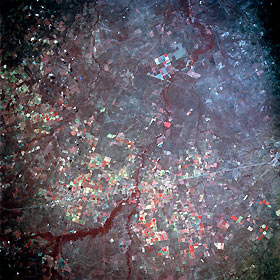
Titre : Pearsall, Texas, U.S.A. July 1992
Description : (La description de cette image n'existe qu'en anglais)
The Frio River is visible as it meanders south and southeast and intersects with Interstate Highway 35. Approximately 12 miles (19 kilometers) north of the highway-river junction is Pearsall, southeast of which is the Pearsall oil field (barely discernible). The smaller town of Dilley lies approximately 5 miles (8 kilometers) south on Interstate Highway 35. Circular field patterns indicate that irrigation is required to provide sufficient moisture for crop production in this part of south-central Texas.
|
|

